In my last post I showed photos of the Jingmei River during and after a major flood. Before writing the last post, I did some research about the river. And for some reason I started to map the entire Jingmei River system in QGIS. QGIS is a geographic information system software that allows displaying, mapping, and analyzing data related to positions on Earth surface.
But not only did I map the river, I also classified each river section according to the stream orders developed by Strahler and Shreve. The Strahler stream order reflects the morphology of a river catchment. On the other hand, the Shreve stream order reflects the hydrodynamics or the amount of water flowing through each river section. Even though it sounds very academic and uninteresting, the results can be turned into nice and interesting maps.
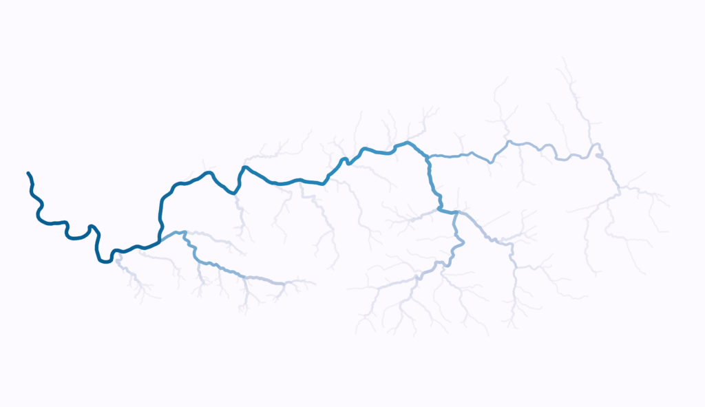
The Jingmei River Network Map
Below is a map of the entire Jingmei River network. The thickness of each section is based on the Strahler order and the color intensity is based on the Shreve order. Major branches have thick lines and minor branches thin lines. The shade of the color represents the theoretical amount of water flowing in these river sections. Light colors mean less water and dark colors mean large amounts of water. Locations, scale or other map features where omitted on purpose.
Seeing a river network like this, is very intriguing to me. It reminds me of blood vessels. Starting with the tiny capillaries, which join into veins or arteries of increasing size.

River catchments
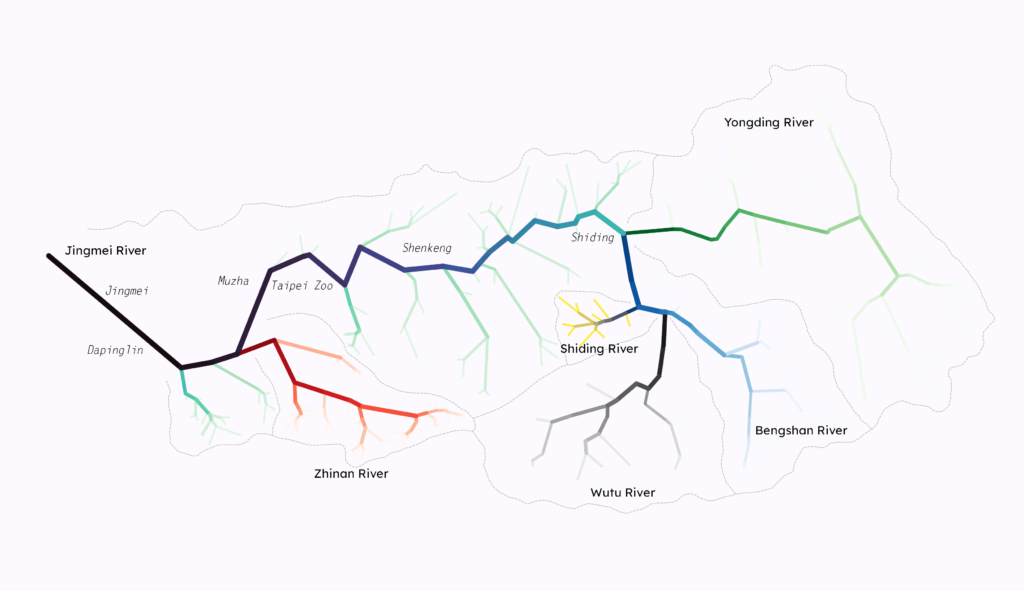
The next map shows the same river system, but this time with straight lines. I only connected the start and end points of each river section. There is no specific reason behind it. It is for artistic reason only. Perhaps there is a scientific application for that, but I am not aware of it. Additionally, the different tributaries and their catchment areas are highlighted in different colors. The same concept for line thickness and color as in the previous map was applied. In this map I have also included some geographic locations to help with the orientation.

The Jingmei River system consists of three main tributaries. Which are the Yongding River, the Bengshan River with its tributaries, and the Zhinan River. From this map you can also see that the Jingmei River originates from the confluence of the Yongding River and the Bengshan River in Shiding. This is also shown as the source of the Jingmei River in official maps.
Interestingly, when applying the Strahler river order to determine the origin of the Jingmei River, then it would be the confluence of the Wutu River and the Bengshan River. A few kilometers further upstream from the official source. Because the Jingmei River has Strahler order 5 and it can be traced until the confluence of these two rivers.
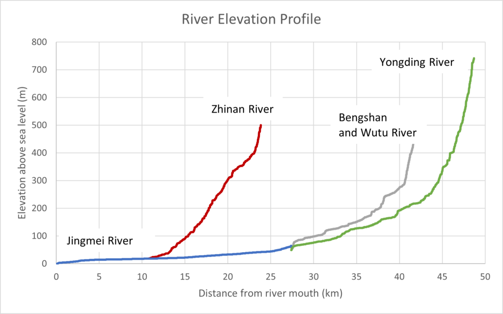
Jingmei River Elevation Profile
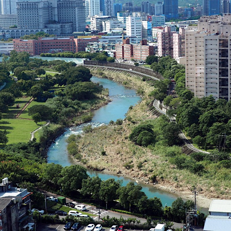
Lastly, I want to show a plot of the river elevation profile. The three tributaries, which feed the Jingmei River, originate in the mountain areas at elevations above 400 m. The gradients of the rivers are very steep, especially the Yongding River has in the source area a drop in elevation within 4 km from almost 800 m down to 300 m. Also the Zhinan River has a very steep gradient that flattens only in the last kilometers before entering the main river. The Jingmei River itself has a very low gradient. In the downstream sections it is almost flat. This low gradient is also reflected by the large meanders that the river developed in the sections from Muzha and further downstream.

Enjoyed this article? You can get early access to my maps, blog posts, and exclusive content by becoming a supporter on Ko-fi. I also share updates and insights on Facebook, post photography and snapshots on Instagram (@eyes_on_taiwan), and showcase maps and Taiwan data on Instagram (@taiwan.maps.dataviz). You’ll also find me on Threads and Bluesky, where I share new maps and links to blog articles. Looking forward to connecting with you!
If you like this content and don’t want to miss new blog posts, consider subscribing to our newsletter!

